On Map zooming, a more detailed explanation of the logic used and how Base Stations Maps are displayed.
Question:
When I zoom out, why do I only see the nearby base stations?
This map is most commonly obtained with the right-click command View On Map from any connected Base station.
Of course clicking on the icon brings up the same detailed tool-tip about the base station as can be seen on the SNIP display itself. But, if this map is requested from outside the Caster (over a web page by an unauthorized user – when you allow this to occur) some other user connection details are suppressed for security reasons.
The Initial view
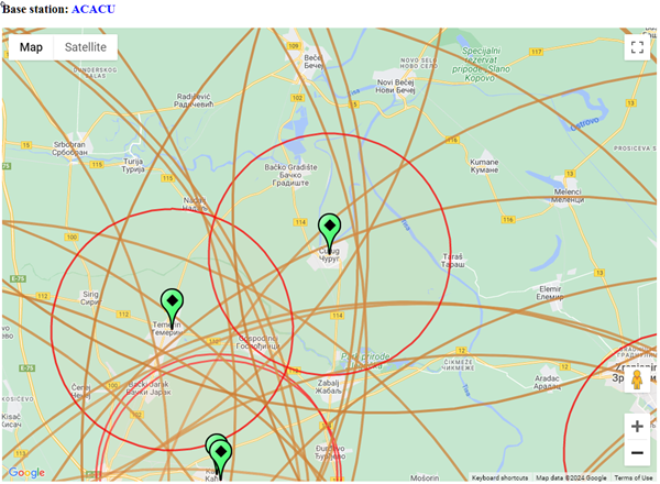 The initial view and zoom is centered around the base itself. It shows about a 25km region on each side.
Other nearby bases (and their radius coverage circles) may also be visible.
(Click image to enlarge)
Zoomed Out View
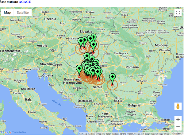 But when the map has been Zoomed out… Base Stations within a preset regional area are also shown on the map. Other bases, further away, are not shown.
(Click image to enlarge)
This is a purposeful design choice, only those bases within ~250km are shown to reduce clutter and page load times. This is also a convenient way to see nearby bases that might be of value to a given user device (NTRIP Clients).
More Bases
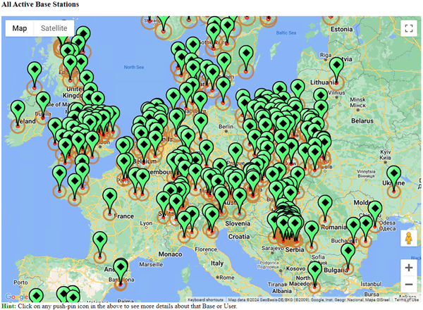 If you want to see ALL the active bases,
then use the menu command:
Reports ⇒ Map View, Bases, In Browser
Or Use the menu item next to it of:
Map View, Bases + Users, In Browser
if you also wish to see the locations of currently connected users plotted.
(Click image to enlarge)
Aside #1: To see all the reservations on your Caster, active or not, do the following.
- On the Push-In table, using the combo box “Select a Report…” along to right side of the tab, select the item Plot All Push-Ins
- You can also plot both the active Push-In bases and any Push-In reservations that have been active over the past week.
Aside #2: From Rev 3.14 onward SNIP now supports OSM style maps (open street maps) as well as Goggle Map API style maps.
- And you can now set the radius size, line color, line width, and fill for the radius circles used on these maps.
Aside #3: From Rev 3.14 onward you can also enable or disable point clustering in the maps. When enabled, many nearby base can be combined into a single point with a numerical count value. Click on the point to see the map expand to show those bases. Try the OSM test map (see this article) to see this at work.