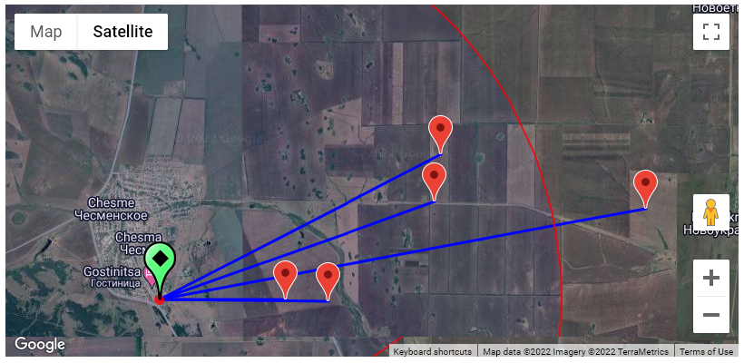
There are several ways to display maps of either connected Users (NTRIP Clients) or Base Station in SNIP. These provide a Google Map view of the object and surrounding features. From SNIP Rev 3.11 onward, radius coverage rings are also added to the images at baseline distances of 10 and 50 km.
The button Display Base and Users in a Map which is found in the Base Station reports when using the Web API can be used to combine these two views into a single map. It shows both the Base Station and all nearby connected Users. In the below image two marine users are connected to the nearby base (click to enlarge these images).
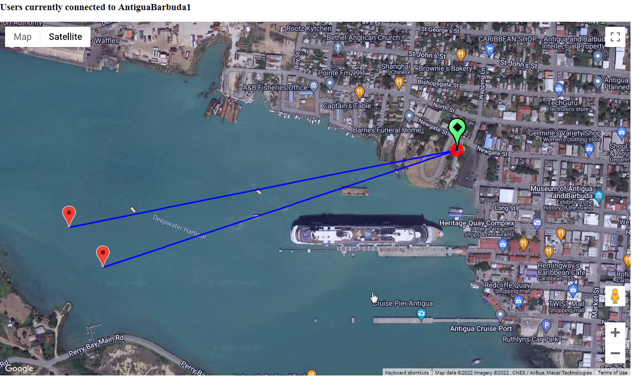
The map is interactive. You can pan and zoom the display. You can refresh the image and this will update the current position of the users.
Two red radius circles are added to the map as well, one at a 10km distance, the other at a 50km distance. These are visible only when the map is zoomed out further. The 10km ring serves to visually indicate the baseline distance beyond which L1-only devices have problems obtaining an RTK fixed mode. In a similar way, the 50km ring indicates the distance beyond which L1/L2 devices will take longer to obtain a fixed mode of operation.
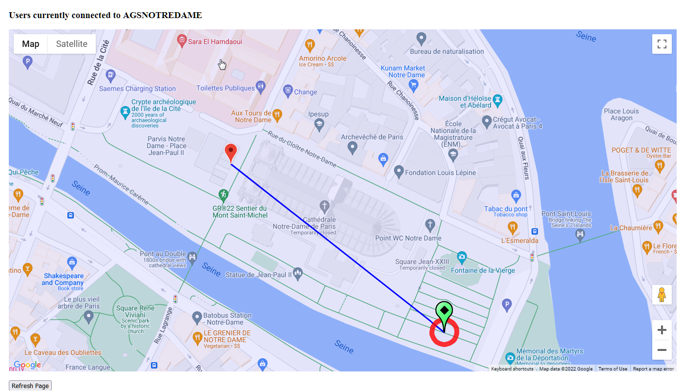
Here is another set of images, taken from a SNIP user engaged in the reconstruction efforts underway at Notre Dame Cathedral in Paris. A single user (a construction crane) is shown near the front of the building. The Base is located in what was formerly a small garden area (now being used for construction staging).
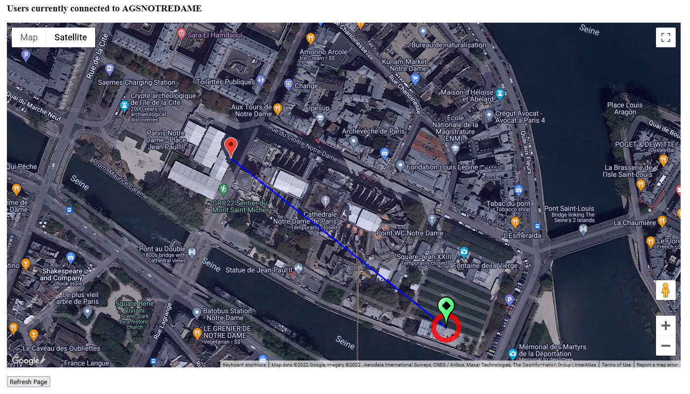 The satellite image is show above, a hybrid street map image is shown below. You can switch between these views on the map. You can also set the default initial view that is displayed to use either a satellite image or a street map in the Preferences dialog.
The map supports the normal tool tips about the User and Bases. Click on any marker icon to display the tip information associated with it. Click again to remove it.
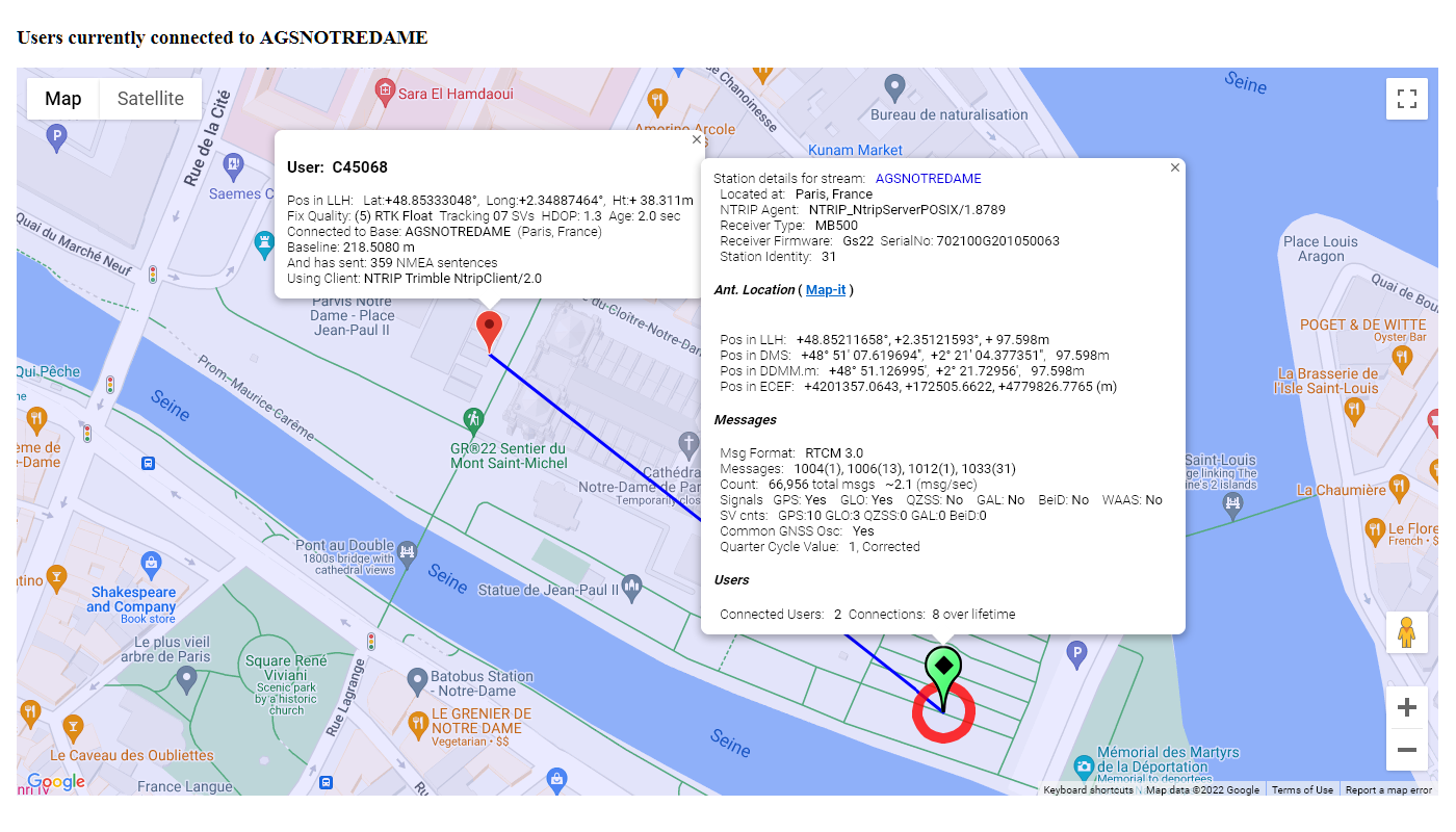
Note that the baseline distance between each user and the Base Station is shown.
When the location of a user is not known (no NMEA $GGA information has been sent to the Caster), SNIP imputes a gross location estimate from the source IP address by using reverse Geo-mapping. When a user is determined to be too far away from the base (over >250km) it is not mapped but is listed in a table below the map.
Recall also that in the Base Station report you are presented a table of the connected users and each of these has both a User Report button and a “just map it” button for that user.